June 7, 1894 - The Great Flood of 1894
In May and June of 1894, heavy rainfall combined with spring snowmelt leading to significant flooding on the Columbia and Willamette Rivers in the Portland area. The Columbia River reached an elevation of 39.7 feet, which is still the highest flood on record to this day.
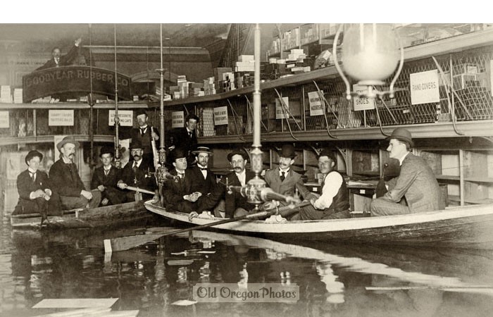
Goodyear Rubber Company during flood of 1894 (www.OldOregonPhotos.com)
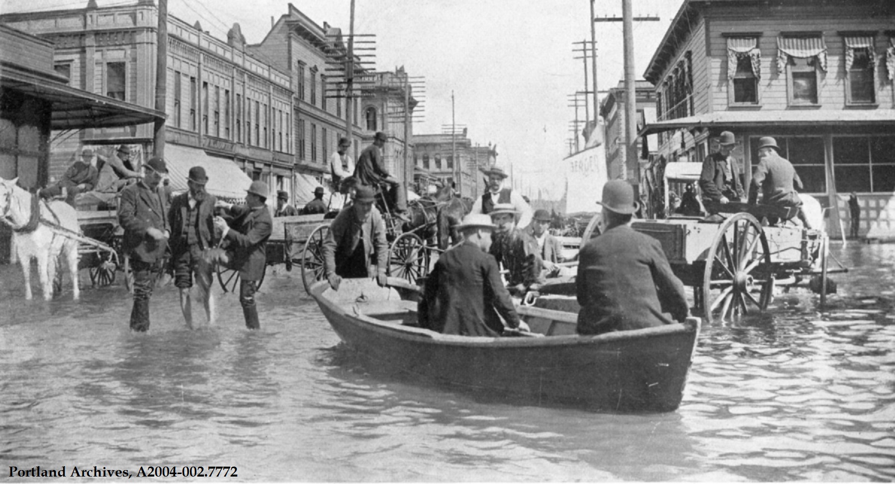
The Willamette River reached an elevation of 33.5 feet, which flooded the business district in downtown Portland, along with the agricultural lands outside of the city. It took almost three weeks for the floodwaters to recede so the residents took to using canoes and other small boats to travel around the city. Kids fished in the streets, restaurants and bars set up on rafts, some shopkeepers even raised their shelves above the water so they could reopen for business.
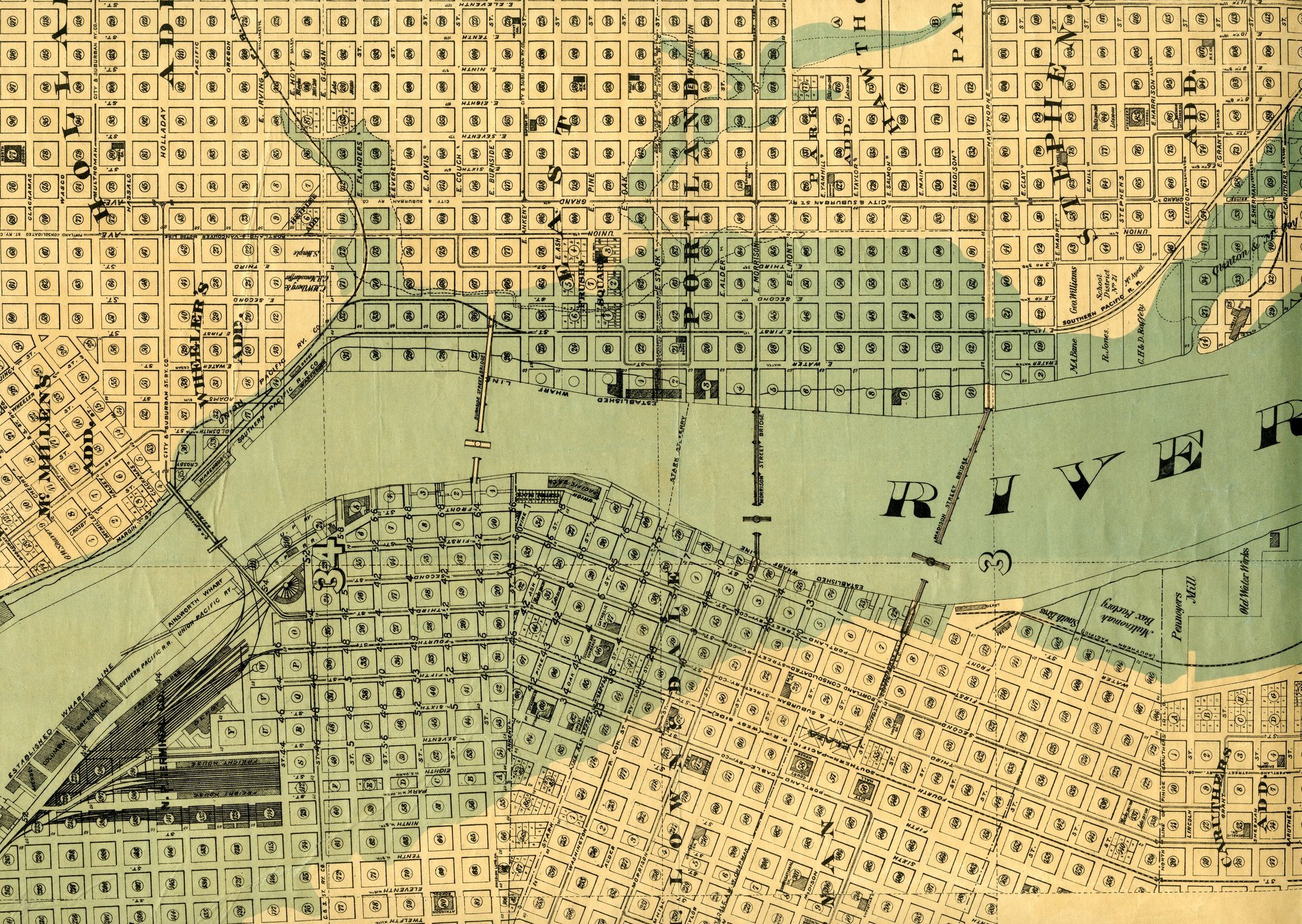
Map depicting the extent of flooding in downtown Portland during June 1894
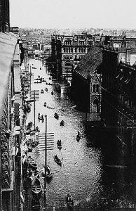
Downtown Portland, June 1894. (Oregon Historical Society)
Once the floodwaters receded, the damage was assessed. According to newspaper reports:
- Sewage laden floodwater had to be pumped from basements and cellars
- Over 100 miles of train track were washed out and service had to be suspended
- Two drawbridges were stuck open, cutting off the western and eastern parts of the city
- Mills, warehouses, docks, and transportation facilities were destroyed, and the foundations of others were destabilized by the erosion and moisture
- On the agricultural lands around the city, soils were eroded, crops and livestock were lost, and farm buildings and equipment were extensively damaged
To this day, the Great Flood of 1894 is considered the “flood of record”- the highest observed level of flooding on record for a given location. It was also the level used by the US Army Corps of Engineers and local governments to determine the appropriate height of the levees constructed along the Columbia River and Columbia Slough in the early part of the 20th century.